
Hurricane Imelda Scrapes Bermuda; More Activity to Watch Behind It
Hurricane Imelda made a very close pass to Bermuda late last night and early this morning, bringing winds of 80-85 miles per hour and storm surge as high as 3-6 feet (see Figures 1 and 2).
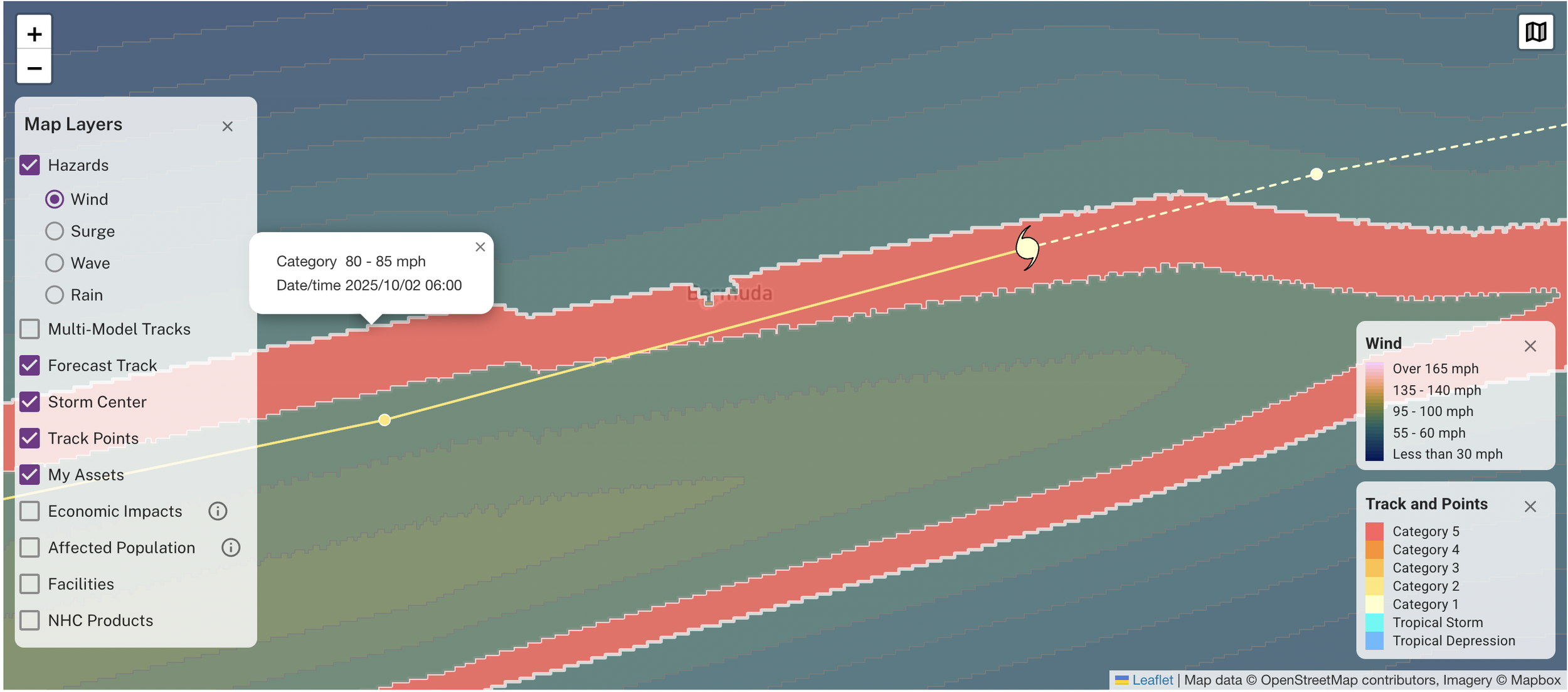
Figure 1: Hurricane Imelda wind field from KinetiCast. The highlighted red area shows where winds of 80-85 mph likely occurred/will occur. The yellow line displays the storm track when Imelda passed near Bermuda.

Figure 2: Storm surge from Hurricane Imelda via KinetiCast. The highlighted red area shows where storm surge of 3 to 6 feet likely occurred/will occur.
The Atlantic is likely to remain busy in the first half of October. Models continue to suggest the potential for a system to develop out of the Main Development Region, and the National Hurricane Center is now highlighting this possibility as well (Figure 3) [1]. The western Caribbean will also need to be watched over the next couple of weeks for the potential for development [2]. The area has remained largely devoid of tropical cyclone activity this entire season, leaving water temperatures and ocean heat content largely untouched (Figures 4 and 5) [3]. And with La Niña developing in the equatorial Pacific, wind shear should remain relatively favorable across this part of the Atlantic basin [4].
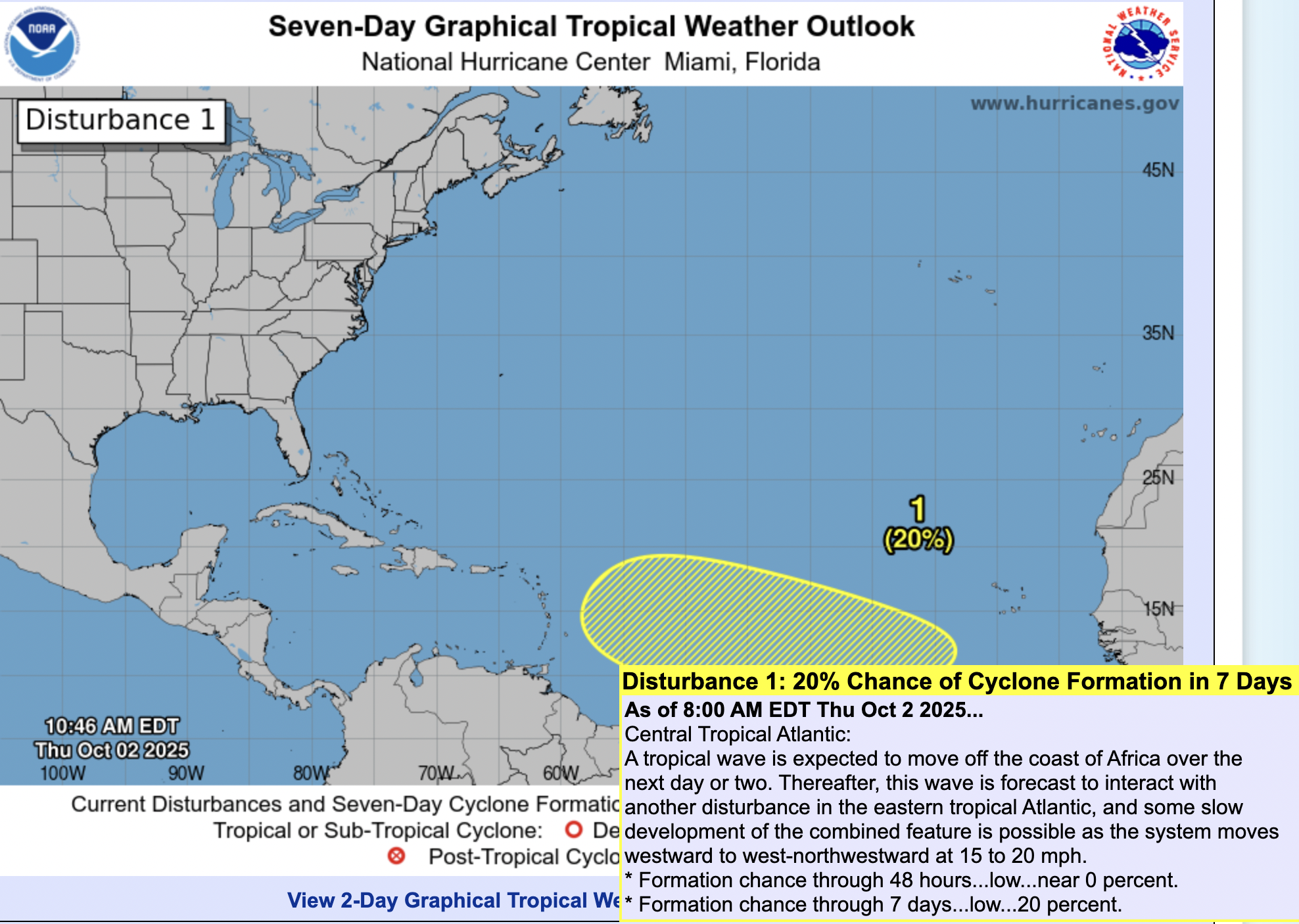
Figure 3: Seven-Day Graphical Tropical Weather Outlook from the National Hurricane Center. Highlighted in yellow is an area with a 20% chance of tropical cyclone formation in the next 7 days.
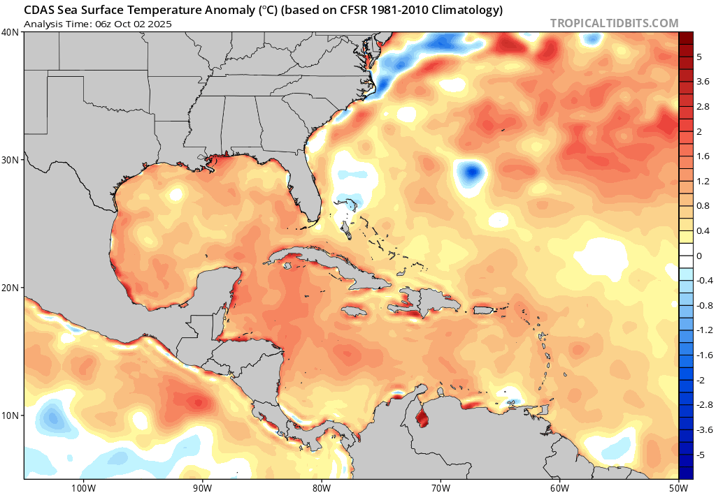
Figure 4: Sea-surface temperature (SST) Anomaly from CDAS valid October 2, 2025. Water temperatures remain significantly above normal in the Caribbean and Gulf of Mexico.
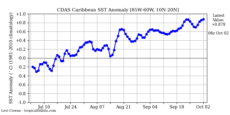
Figure 5: Sea-surface temperature (SST) anomaly time series for the Caribbean, showing how SSTs have been on an upward trend in the region the last several weeks.
As always, Kinetic Analysis will be providing updates as the situation unfolds. We hope that Bermuda has a speedy recovery following Hurricane Imelda.
References