
Erick Becomes a Hurricane, Expected to Make Landfall in Mexico
While the Atlantic has been quiet since the start of the hurricane season, the Eastern Pacific has just produced its 5thtropical system in under 3 weeks [1]! Hurricane Erick is expected to continue tracking to the northwest over the next couple days, eventually making landfall in the Mexican state of Guerrero [1]. Guerrero includes the city of Acapulco, which was devastated by Hurricane Otis in 2023 [2]. The latest forecast from the National Hurricane Center calls for a Category 3 with maximum sustained winds of 115 miles per hour before landfall. In Figure 1 below you can see the forecast and past modeled wind fields (down to <2 km resolution) as displayed in our interactive web app, KinetiCast™. Note that this information could change as forecast track and intensity are updated. A “zoomed in” view of the winds is shown in Figure 2.
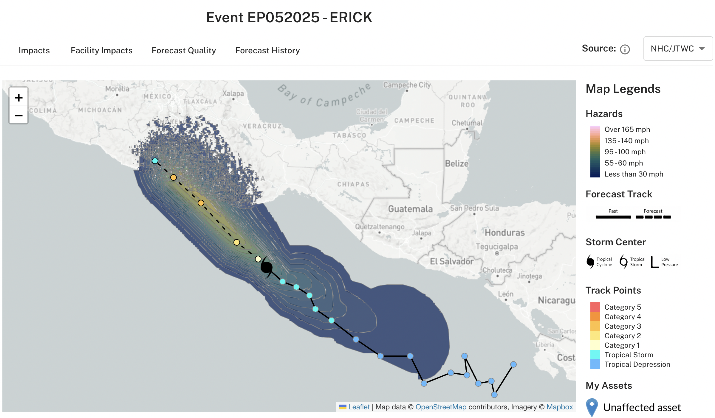
Figure 1: Projected wind swath of Hurricane Erick, generated by KinetiCast™ models using forecast data from the National Hurricane Center. The tropical cyclone symbol denotes the storm position for this forecast. The filled circles are color-coded by intensity. The circles on the dashed line represent the forecast position of the cyclone at 12-hour intervals, and the circles on the solid line depict the past position of the storm at 6-hour intervals.
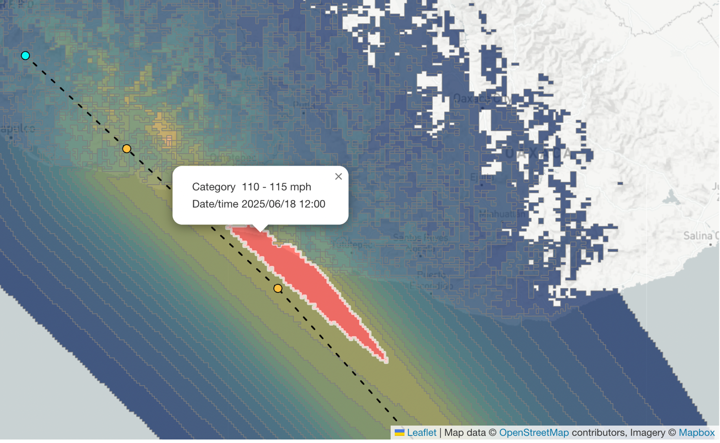
Figure 2: Zoomed-in view of the forecasted wind field from Hurricane Erick. The highlighted red area shows where winds of 110-115 miles per hour have the potential to occur.
Figure 3 shows the economic impact forecast from Hurricane Erick. With the current track and intensity forecast, the brunt of the impact (~330 million USD) is expected to occur in Guerrero. However, this is also subject to change depending on changes in the future track and intensity of the storm.
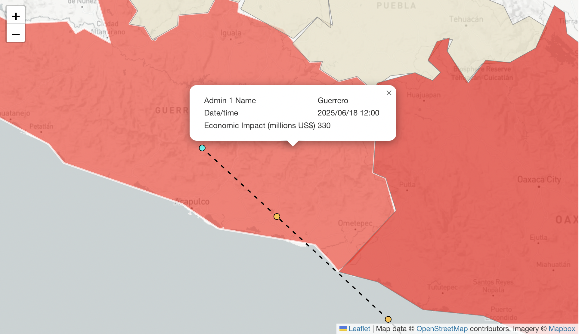
Figure 3: Economic impact forecast from KinetiCast™, highlighting the Mexican state of Guerrero.
All hurricane season long, Kinetic Analysis Corporation is here providing you with up-to-date information before the next storm strikes. Not only do we provide you with a detailed view of the hazards (wind, storm surge, and rain) down to a less than 2 km area, but also the impacts associated with those hazards (economic losses, affected populations, and facility impacts). In addition, we also allow users the ability to upload their own asset information right onto our web app. Want to receive real-time alerts whenever a tropical storm/hurricane may affect you, including information such as the projected economic impact, evacuation time, and downtime? Reach out to us at sales@kinanco.com to request a free 15-minute consultation.
References
1.https://www.weathernationtv.com/news/Eastern%20Pacific%20Hurricane%20Season%20Off%20to%20a%20Fast%20Start,%20Atlantic%20Remains%20Quiet
2. https://www.nhc.noaa.gov/data/tcr/EP182023_Otis.pdf