

KinetiCast™ is Kinetic Analysis’ flagship online platform, transforming real-time data from our proprietary models into an interactive dashboard that provides global insights on tropical cyclone hazards and impacts as soon as they are available. With map, table, and graphical components, the platform enables the user to easily filter and digest data. Summary information (e.g., of estimated losses and facility impacts) are complemented by the option to view itemized details to accommodate any use case. Gone are the days of manually retrieving, ingesting, and processing data one .zip file at a time. KinetiCast™ is here to save you valuable time so you can focus on what matters most: seizing control of the hazards to come.
KinetiCast™ is priced using a subscription-based model with an annual fee structure. Offerings at each subscription tier are outlined on our Pricing page. For more information and/or a quote, please contact us at sales@kinanco.com.
KinetiCast Features
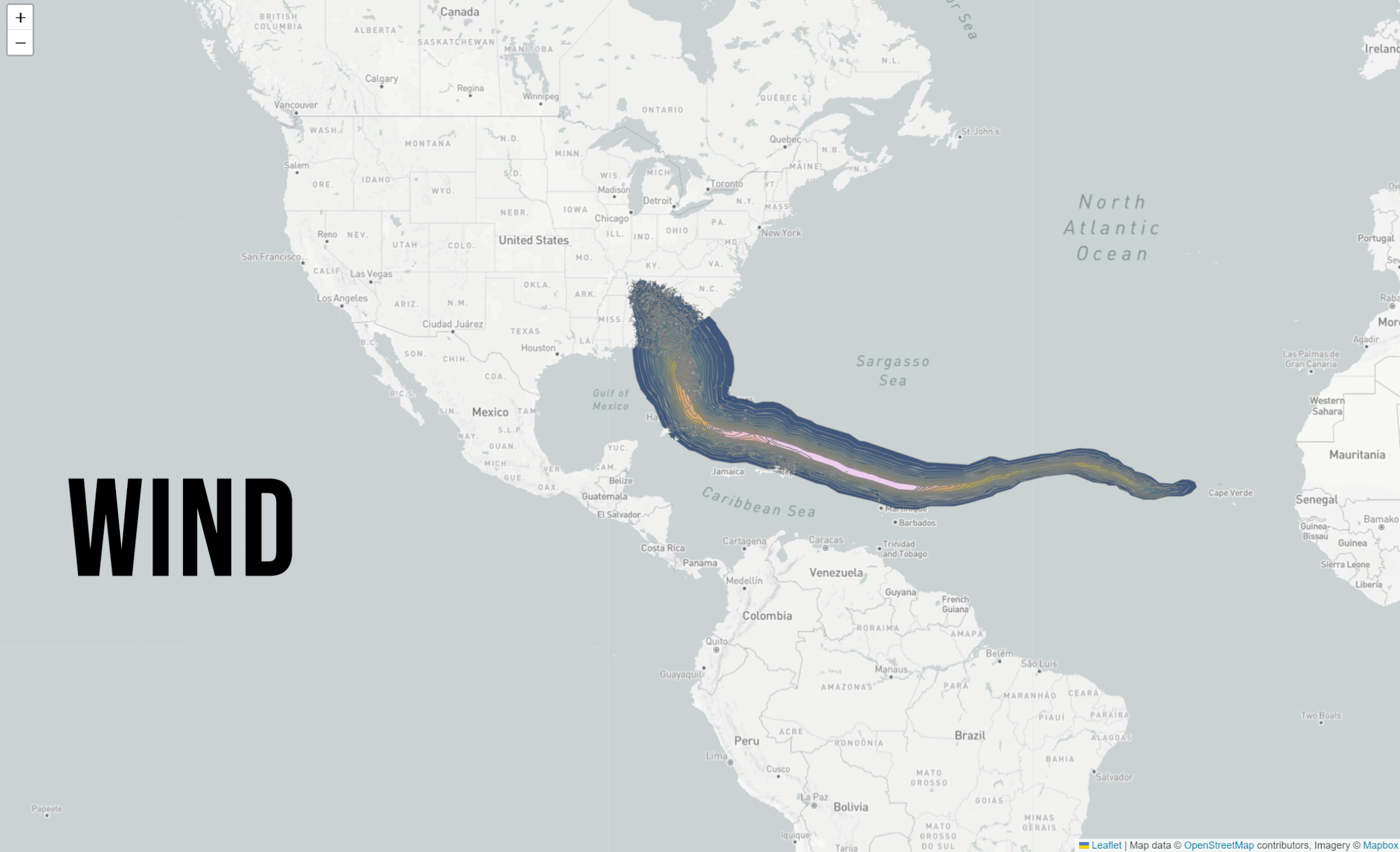
Spatial Distribution of Hazards
-
Maximum Winds
Storm Surge Inundation
Significant Wave Height
Cumulative Rainfall
-
Available in real-time at 60 arcsecond (~2km) resolution
Hazards account for surface roughness, topography, bathymetry, coastlines, astronomical tides, and more
Global coverage available ~30 minutes after a forecast update
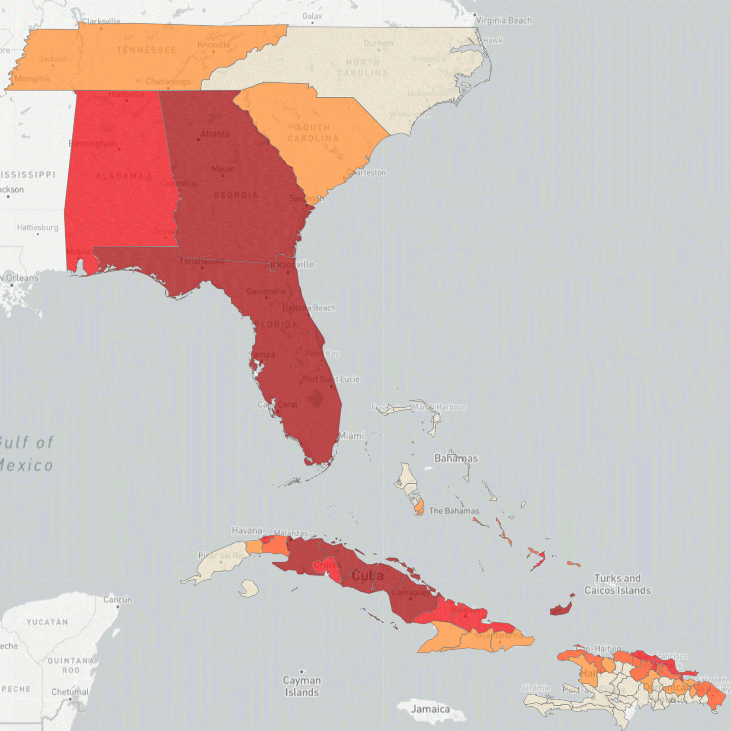
Economic & Facility Impacts
-
Adjusted to US$
Aggregated to Administration Levels 0, 1, and 2 (e.g. country, state, and county)
Available in map and table format
-
Structural and content damage for airports, seaports, hospitals, and energy generation facilities
Estimates of facility shutdown duration and time before full recovery
Available in map and table format
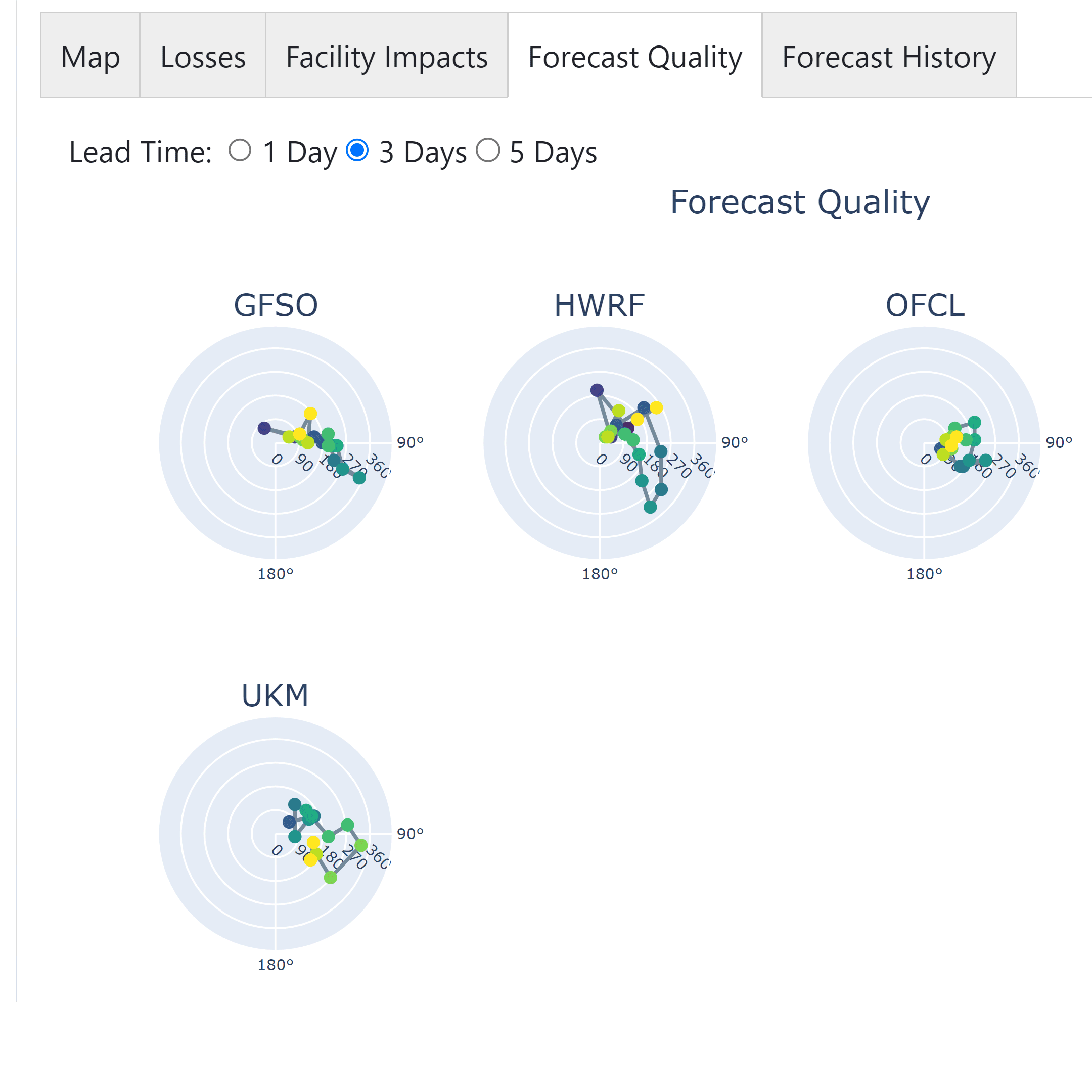
Multi-Model Views
-
View hazards and impacts modeled using a multitude of regional agency forecasts and global numeric models
Compare multi-model storm tracks with the National Hurricane Center’s Cone of Uncertainty to gauge spread of model forecasts for a given storm
-
Plots that compare how different model forecasts are performing compared to the storm’s real-time progression at various lead times
Evaluate which models are performing the best for a particular storm and prepare for a more comprehensive range of potential impacts