
Cyclone Amphan
Given the approach of Cyclone Amphan to the northern end of the Bay of Bengal we thought it would appropriate to give an example of our wind and storm surge footprints based on the JTWC forecast. For the hazard footprints shown below, our models use the forecast data from JTWC. Our real-time model resolution is 1 arc minute.
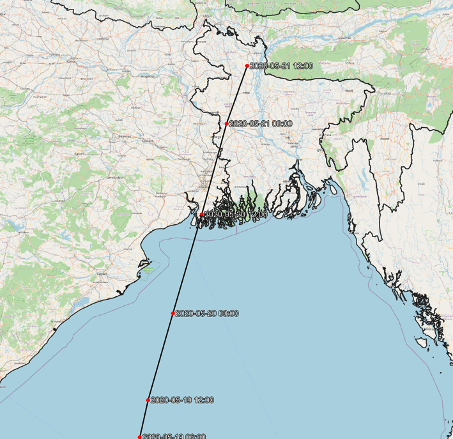
The forecast track is shown below. When looking more closely in the area of landfall, we see that landfall is forecast just to the west of Sundarban National Park.
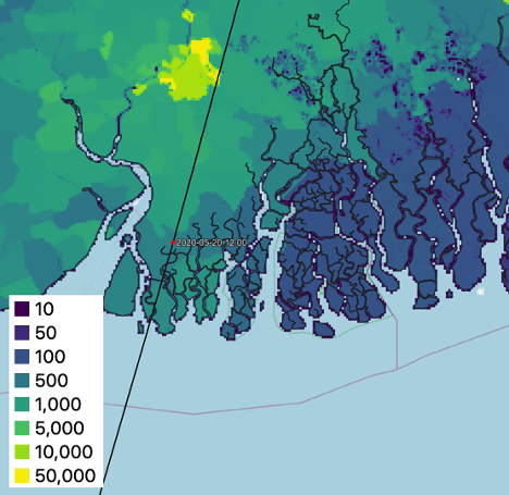
An example of the population in the area can be had by looking at the estimated of population per 1 km2 using data from NASA EOSDIS SEDAC. According to the estimate for 2015, in the area near where the eye is forecast to make landfall, there are on the order of 1,000 people per square kilometer. Note the scale in the figure below is not linear. Kolkata is the yellow area to the north.
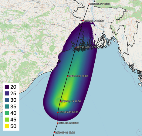
Our wind modeling shows the distribution of maximum sustained two-minute winds greater than 20 meters per second (nearly 40 knots). Fortunately, Cyclone Amphan is expected to weaken prior to landfall . The wind scale is in meters per second.
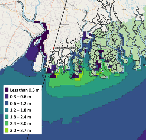
Despite the decrease in wind speed, storm surge remains a significant risk. Our modeled storm surge suggests that people in the area to the east of region of landfall will experience inundation levels of over 3 m. The significant storm surge is due to several factors including the system’s earlier status as a severe tropical cyclone and its size causing a surge consistent with a storm of greater intensity as well as the orientation of the coastline causing a funneling effect that focuses the surge at the apex of the bay.
We emphasize that people in the area should follow the forecast guidance and advice offered by the IMD. Our data are not official and are based on JTWC forecasts which may differ signficantlly from the IMD.